KwangSoo Yang
KwangSoo Yang
 |
KwangSoo Yang is an Associate Professor in the Department of Electrical Engineering and Computer Science at Florida Atlantic University.
yangk@fau.edu |
Announcement
- We are looking for full-time Ph.D. and research master's students who are interested in doing research in the area of database, graph algorithms, big data processing, and data mining. Research assistantships are available from Mar.2019 to Feb.2024 under CAREER: Spatial Network Database approach for Emergency Management Information Systems. For additional information, please contact: yangk@fau.edu (Prof. KwangSoo Yang) and directly send CV/resume and description of your research interests and background.
Research Projects
- NIH: In-Vehicle Sensors to Detect Cognitive Change in Older Drivers ($6,130,807); 2020 - 2024, NIH, (Co-PI with Dr.Tappen, FAU)
 CAREER: Spatial Network Database approach for Emergency Management Information Systems (Mar. 2019 - Feb. 2024, National Science Foundation
- Development of a Traffic Map Evaluation Tool for TMC Applications ($243,706); Feb. 2017 – Dec. 2018, Florida Department of Transportation, (Co-PI with PI Dr. Stevanovic, FAU)
- OURI Undergraduate Research Grant: Florida Emergence Evacuation Route Planning ($1,200); Jan. 2018 – Dec. 2018, Florida Atlantic University
Education
- Ph.D., University of Minnesota
- MS., University of Minnesota
- BS., Yonsei University
Research
- Spatial Database
- Spatial Data Mining
- Graph Algorithm
Teaching
Synergistic Activities
- PC member for ACM SIGSPATIAL
- TPC member for GraphSM
- Editorial Board Member of Korea Spatial Information Society
Jouranl / Conference Paper Review
- IEEE Transactions on Knowledge and Data Engineering (TKDE)
- International Journal of Geographical Information Science (IJGIS)
- GeoInformatica
- International Conference on Advances in Geographic Information Systems
Spatial Database and DataMining Application
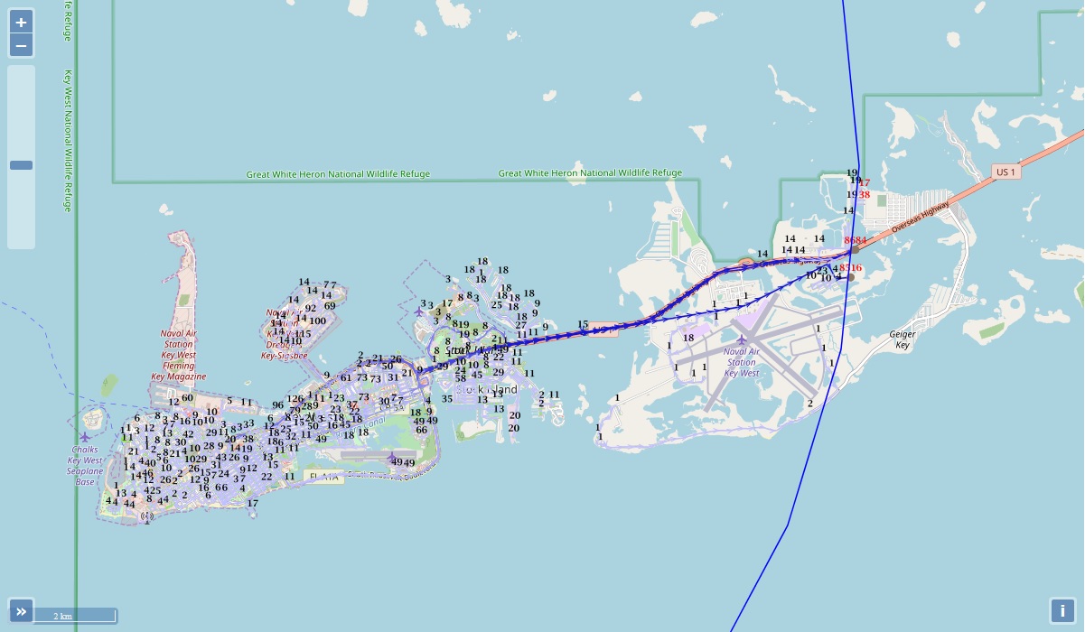
1) Evacuation Route Planning (A Dartboard Network Cut Based Approach to Evacuation Route Planning)
Click the image to see the application (Note that the server is very slow due to the limited capacities of cpu and memory)
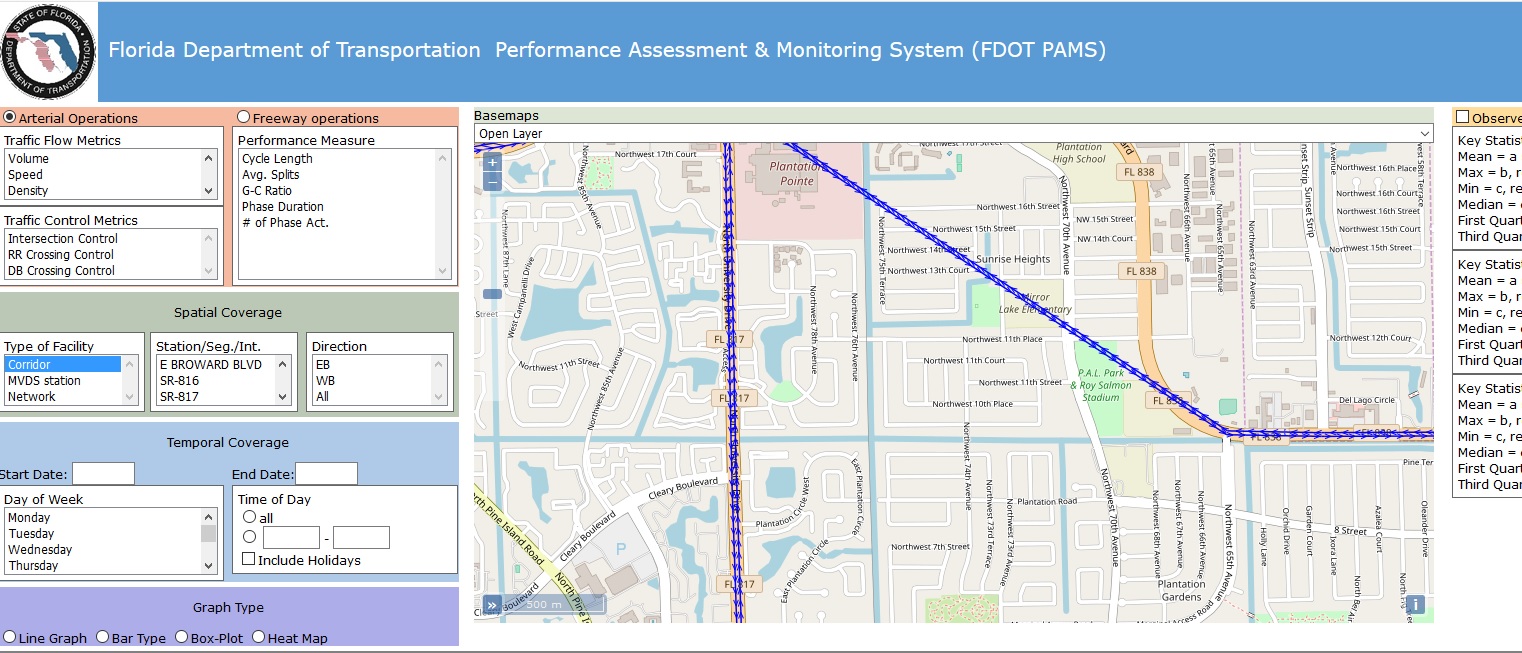
2) Florida Department of Transportation Performance Assessment & Monitoring System (FDOT PAMS)
Click the image to see the application
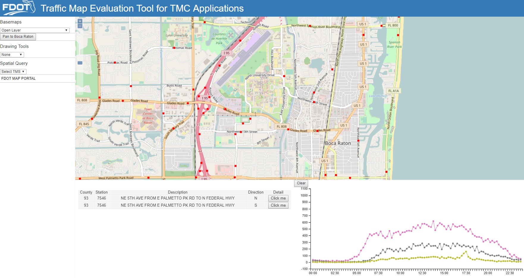
3) Traffic Map Evaluation Tool for TMC Applications
Click the image to see the application
4) Florida Department of Transportation Performance Assessment & Monitoring System (FDOT PAMS)
Click the link to see the application
![]()