__________________________
Dr. T. has worked on the development of a number of innovative simulation and modeling environments/tools for understanding hydrological processes, hydrometerological observations, climate change and variability. Some of the environments/tools developed are available in public domain. A few practical tools are developed with funding from state and federal agencies. Description of select HYDROINFORMATICS-specific practical application-oriented tools developed at by Dr. T. at HRL are provided here.
- Water Budget Assessment Tool for Stormwater Treatment Areas (STAs). The tool is almost completed. Designed and developed by Dr. T. and Mr. Sai Muppala.

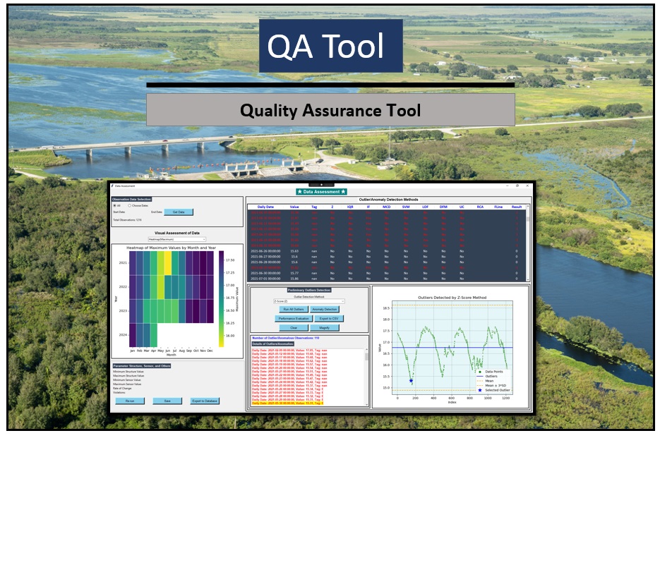
- Machine Learning-based Outlier and Anomaly Identification Methods for Hydrological Data : QA Tool. Designed and developed by Ramesh Teegavarapu and Vivek Sonar (ongoing work, 2023-2024).
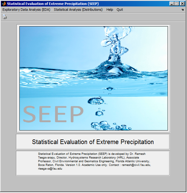
- Statistical Evaluation of Extreme Precipitation (SEEP) – Designed and developed by Dr. Ramesh Teegavarapu (2014)
SEEP is a state-of-the-art software for analysis of hydrological time series, especially precipitation extremes. SEEP includes an exhaustive EDA (exploratory data analysis) module also.
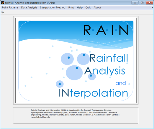
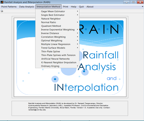
- Rainfall Analysis and INterpolation (RAIN) – Designed and Developed by Dr. Ramesh Teegavarapu (2012). Available in Public Domain.
RAIN provides several spatial interpolation methods for estimation of missing precipitation data at a site. Analysis of rainfall in space and time is also possible using RAIN. This software can also be used for interpolation of hydrometeorological variables. RAIN software provides over 20 deterministic and stochastic interpolation methods.
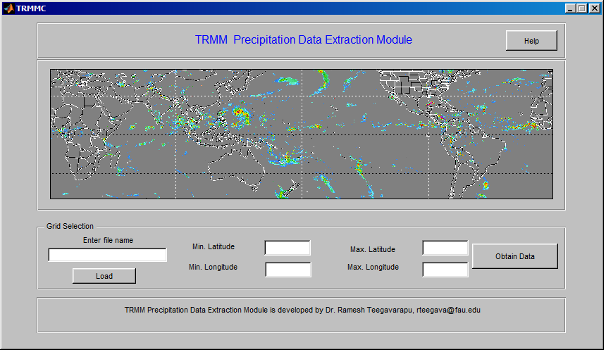
- TRMM – Precipitation Data Extraction Module – Designed and Developed by Dr. Ramesh Teegavarapu (2014)
This software helps in extracting and processing Tropical Rainfall Monitoring Mission precipitation data.
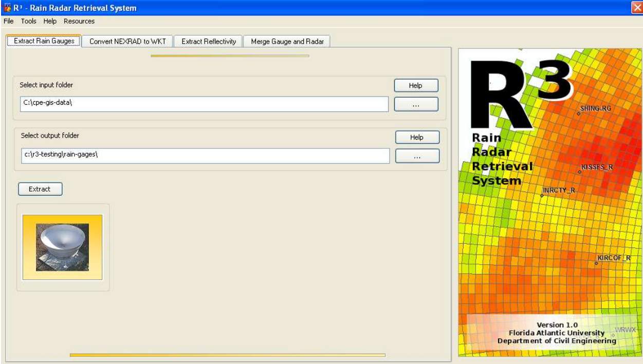
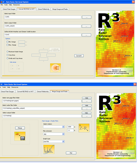
- Rain Radar Retrieval (R3) – Designed by Dr. Ramesh Teegavarapu. Developed by Dr. T and Mr. Andre Ferreira.
R3 is a comprehensive rainfall and radar retrieval software developed to: 1) obtain rain gage data; 2) process radar-reflectivity values to obtain rainfall totals; 3) evaluate radar data in space and time.
- Bias Assessment Tool (BAT)– Designed by Dr. Ramesh Teegavarapu. Developed by Dr. Ramesh Teegavarapu and Dr. Aneesh Goly
BAT is developed to evaluate radar data using several statistical and performance indices. It is can used for evaluation of hydrologic models and any simulation model-generated results. BAT can be used for forecast verification of precipitation forecasts available from National Weather Service (NWS). Currently used by SFWMD. BAT consists of several error and performance metrics for evaluation of radar data at different temporal and spatial resolutions.

- Stage Data Evaluation Tool (SDET) – Designed by Dr. Ramesh Teegavarapu. Developed by Dr. Ramesh Teegavarapu and Dr. Aneesh Goly
SDET is now modified as HDET (Hdryologic Data Evaluation Tool) to identify and evaluate: 1) anomalies and 2) outliers in hydrometeorological time series data. Currently used by SFWMD.

- Statistical Downscaling Model (SDM) for Precipitation – Developed by Dr. Aneesh Goly (Post Doctoral Scholar) under supervision of Dr. T.
- Water Balance Model (WBM) – Developed by Dr. T. and Dr. Aneesh Goly
WBM is a four parameter conceptual water balance model for any spatial temporal resolution. The model parameters are calibrated using nonlinear optimization. The model can be applied for climate change studies.

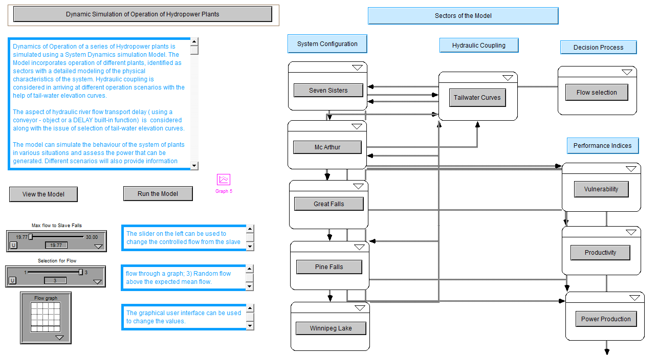
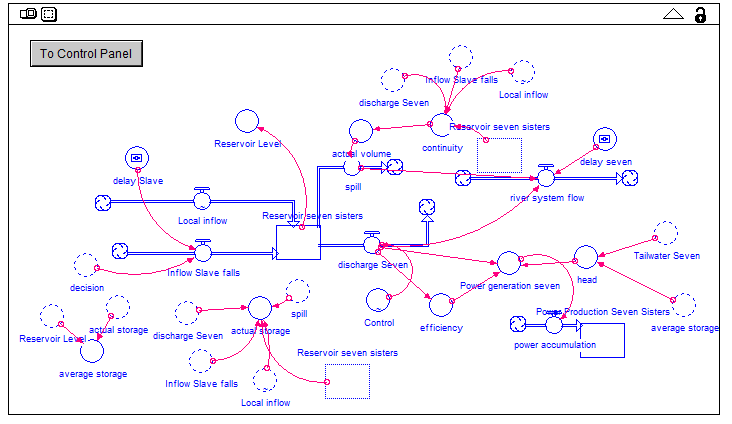
- System Dynamics Simulation – Developed by Dr. Ramesh Teegavarapu
Object-oriented simulation models are developed based on system dynamics principles for operation of hydraulically coupled hydropower systems. These models can be used for real-time operation of hydropower and water supply reservoir systems. Systems are also developed for many watershed modeling/water quality modeling.
Decision Support Systems
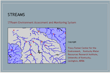
- STReam Environment Assessment and Monitoring System (STREAMS) – Developed by Dr. Ramesh Teegavarapu
STREAMS is a knowledge-based decision support system developed by Dr. Teegavarapu using a rule-based skeleton and visual BASIC front-end.
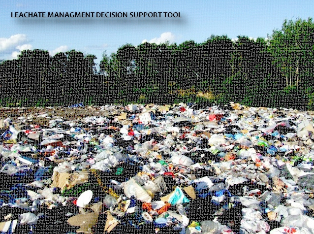
- Leachate Management Decision Support System
Leachate management decision support system is a web-based knowledge-based system for providing guidance to waste management personnel for effective leachate management. Conceived and designed by Dr. Teegavarapu.
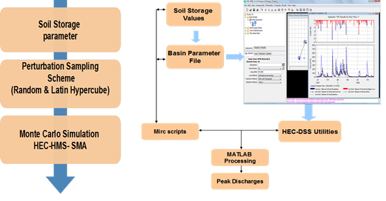
- Uncertainty Analysis of Soil Moisture Accounting within HEC-HMS – -Developed by Dr. T and Mr. Andre Ferreira
Module for uncertainty analysis of peak discharges based on soil storage parameters. Links with HEC-HMS.
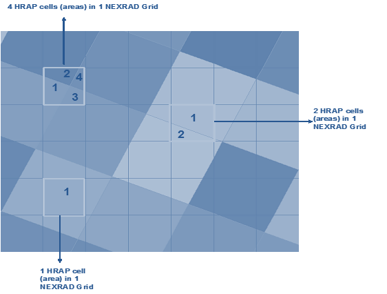
- Grid-based Transformations of Multi-Sensor Precipitation Estimates -Developed by Dr. Teegavarapu.
Evaluation of methods for geometric transformation of HRAP (Hydrologic Research Analysis Project) grid to Cartesian grid Evaluation of available spatial analysis techniques for achieving the transformation Development of multiple spatial transformations/approaches, and test and evaluate the performance of each of these approaches. Implementation of the transformation approach to obtain estimates of rainfall for 2 km x 2km Cartesian grid for the period of interest
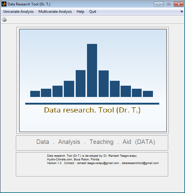
- Data research. Tool (Dr. T.) – Designed and developed by Dr. Teegavarapu
Data research tool (Dr.T.) is comprehensive data analysis tool that can be used for any type of data. It is under development. When completed this tool will be the most comprehensive data analysis tool that is generic and will have abilities to deal with uni-variate and multivariate data.
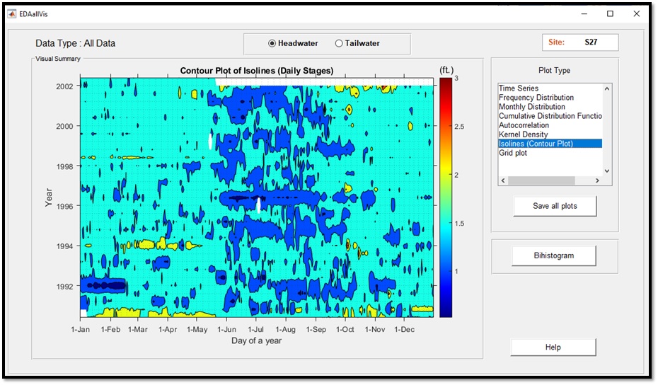
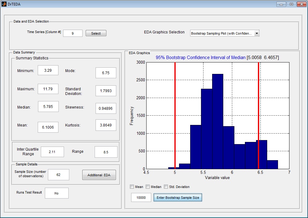
EDA Interface
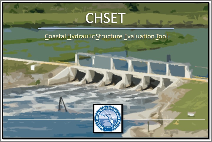
- Coastal Hydraulic Structure Evaluation Tool (CSHET) – Designed and developed by Dr. Rahul Kumar and Dr. Teegavarapu
- CHSET: Coastal Hydraulic Structure Evaluation Tool is developed to evaluate critical hydraulic conditions (identified by head and tailwater stage conditions) for the level of service or performance assessments.
- The tool has several modules that are helpful in the assessment of stage data.
- It also includes modules for statistical and visual assessments
- Several performance indices are designed for preliminary assessment of hydraulic structure operations.
- Data from coastal hydraulic structures can be used for assessment with the help of CHSET.
- It is standalone, modular, and user-friendly.