________________________
ResearchInterests
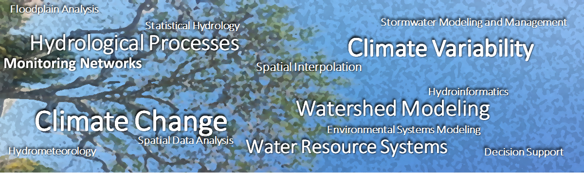
Climate Change . Climate Variability . Water Resources Systems. Watershed Modeling . Hydrologic Modeling . Precipitation Processes . Stormwater Modeling and Management . Monitoring Networks . Hydrometeorology . Statistical Hydrology . Decision Support Systems . Hydroinformatics . Hydroanalytics .
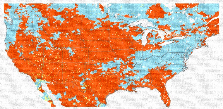
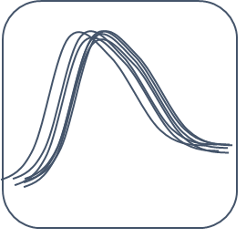
[Spatially varying precipitation totals across the U.S. during ENSO. Red : El Nino, Blue: La Nina ] . Adopted from a research study conducted at HRL.
ResearchInitiatives
SPACE (Spatial Precipitation Analysis for Continuous Estimation), R3 (Rain Radar Relations)

Extreme precipitation and climate change and variability. Understanding the trends
precipitation extremes over time and changes in characteristics. Statistical analysis of extremes. Current research is focused on evolving precipitation/streamflow extremes individually and jointly and influences of coupled oceanic-atmospheric oscillations.
Development of new deterministic and stochastic spatial and temporal interpolation methods for reconstruction of missing precipitation records. Statistical corrections, optimal methods with selection of control points in space. Several methods are available in RAIN (Rainfall Analysis and INterpolation) software developed by Dr. T. Current research is focused on development of proximity metric-based methods. Part of the SPACE (Spatial Precipitation Analysis of Continuous Estimation) initiative started by Dr. T.
Development of statistical downscaling of hydro-climatic variables at different temporal and spatial scales. Optimal selection of predictor variables. Current focus is on the improved function approximation methods.
Climate Variability and Teleconnections: Spatial and temporal influences
of coupled oceanic-atmospheric oscillations on precipitation extremes. Indentification
of spatial extent of these influences considering regional hydroclimatology.
Focus is on evaluation of statistical evaluation of extremes/climate change trends. Development of parametric and nonparametric approaches for assessment of extremes in space and time.

Extreme Precipitation and Floods: Evaluation of streamflow extremes under
changing climate, climate variability, joint evaluation of precipitation and streamflow extremes.
Radar and Satellite-based Precipitation estimation and analysis using optimal function approximation methods. Bias analysis and corrections.
Climate Change and Future Trends in Hydroclimatic Variables: Variation of essential climatic variables over time, development of indices to quantify the changes, statistical tests to evaluate trends.
Watershed Modeling/Water Quality Fate and Transport Modeling:
Simulation models for modeling fate and transport of nutrients and pathogens at different spatial scales under data poor conditions, optimal reduction in pollutant loads.
Catastrophic Floods: Animation and Visualization. 4-D visualization
schemes are developed to evaluating the impacts of extreme floods in urban environments. Research is focused on development of metrics for assessment of flood risk in space and time.
Water Resources/Environmental Systems Optimization:
Development of optimization using linear and nonlinear formulation for
optimization of water resource systems under environmental, ecosystem and monetary constraints. Studies include: hydropower systems, Lake operations, irrigation systems,
stormwater management systems.
Uncertainty Analyses Approaches in Hydrologic Modeling: Methods for addressing
different types of uncertainties in hydrologic/hydraulic modeling inputs and results.
Environmental and Water: Intelligent/Knowledge-based Decision Support Systems:
Knowledge-based decision support systems for real-time operation of water resource systems, stream quality evaluation, leachate management and environmental systems.
Spatial analysis and Geographical Information Systems. Spatial interpolation and analysis of evaluation of hydrometeorological parameters, geostatistics, monitoring network design and methods of missing data estimation in space and time.
Hydrologic Design and Water Resources Management under Changing Climate.
Focus is on sustainable and climate-change sensitive optimal hydrologic design considering uncertainties associated with future precipitation extremes derived from
GCM-based models.
Hydroanalytics
Hydroanalytics deals with use of statistical, visualization, computer and data sciences to analyze hydrological and meteorological data in space and time for understanding hidden patterns, variations, anomalies, outliers, trends and all the characteristics of data to develop descriptive and prescriptive models for hydrological processes
The icons with graphics are created by Dr. T. and are copyrighted. (© Dr. T.)
Publications
Books
Journal Publications
Conference Publications
Poster Presentations
Oral Presentations
Technical Reports